Since the National Science Foundation funds a large fraction of academic computer science research in the USA, we often end up traveling to Washington to visit the NSF. This post is just to say that if you are traveling light, if you need some exercise, if you have a bit of free time, and if the weather is good, it is feasible and pleasant to walk or bike from Reagan Washington National Airport (DCA) to the new NSF location in Alexandria.
The short version is:
- Don’t follow Google Maps in pedestrian mode, which finds a not-great route
- Do follow the Mount Vernon Trail, which connects DCA and Old Town Alexandria in a pretty direct fashion
I’ve walked this route in both directions; it’s roughly five miles and takes me 80 or 90 minutes (I’m a pretty fast walker so ymmv). I have not biked it, but Capital Bikeshare has several stations near DCA and quite a few stations scattered around Alexandria — so this seems like a great option, assuming that your luggage is in a backpack or something else hands-free.
Here’s an overview of the whole route:
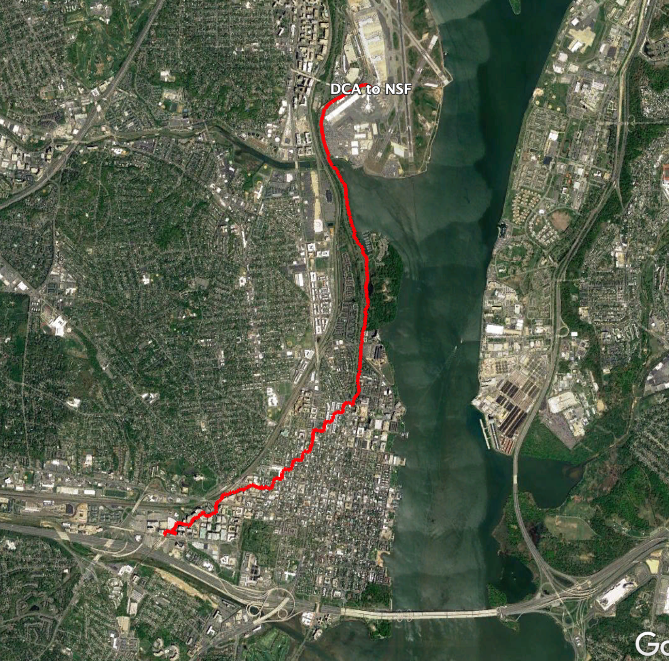
To help orient yourself, the beltway runs across the bottom of the image, the Potomac River runs north to south, you can see DCA’s runways towards the top, and Old Town Alexandria is in the triangular area in between the Potomac, the beltway, and the red walking route.
The only potentially tricky bit is locating the Mt Vernon Trail. Starting anywhere in the airport, walk to Terminal A and go outside to the semicircle-shaped pickup/dropoff area, and then find a sidewalk going roughly southwest. The road you want to walk along is South Smith Boulevard. Don’t cross under the Metro tracks and also don’t go down a level to Thomas Avenue, which gives access to some of the buildings right next to the airport terminal. This may be helpful:
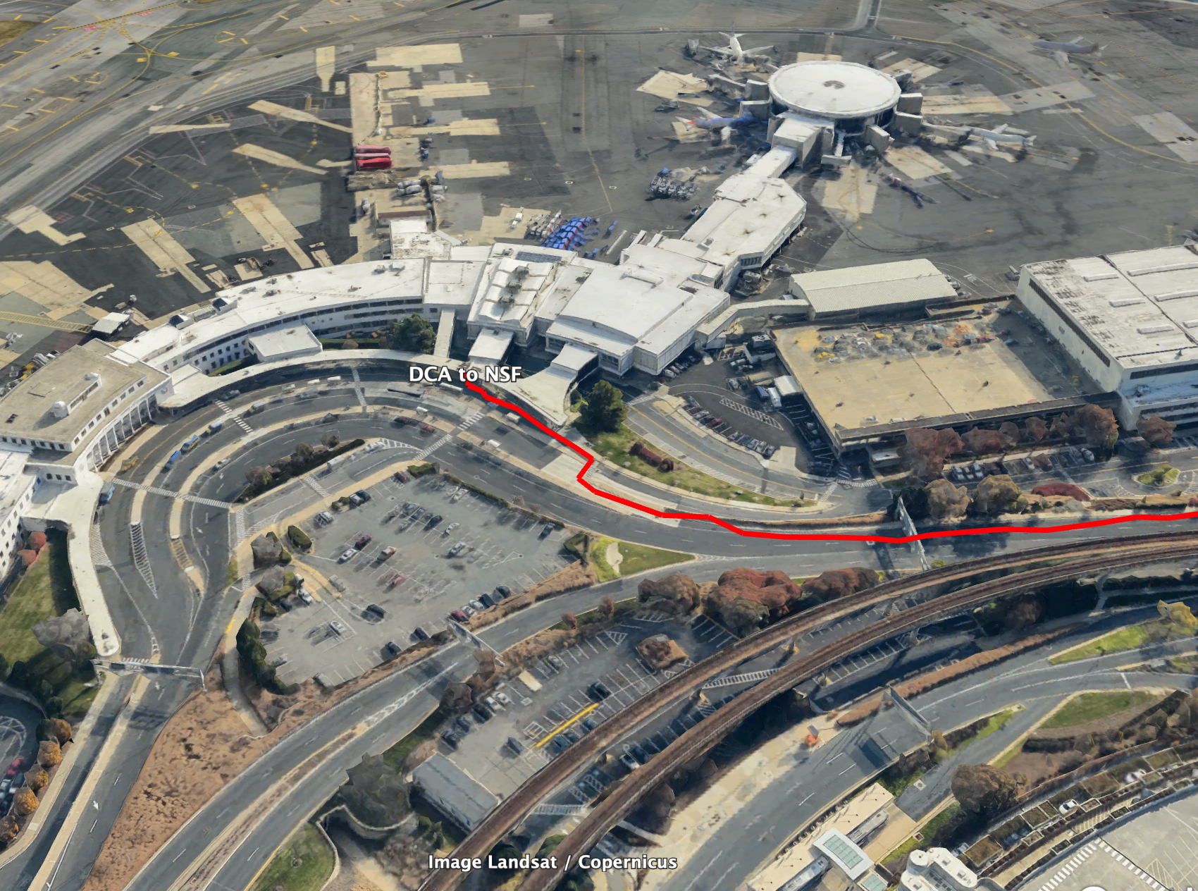
In less than half a mile, as you reach the end of the airport-related buildings, the Mount Vernon Trail, paved with a dotted yellow center line, is easy to see and you should move over to it here (open kmz files in Google Earth). This is all pretty obvious on the ground, and there are some helpful signs. Whatever you do, don’t cross the George Washington Parkway — the busy divided highway that runs nearby.
Follow the Mount Vernon Trail past Daingerfield Island to Alexandria, at which point the trail forks and the Mount Vernon Trail heads over towards the Alexandria waterfront. This is a nice walk if you have time, but it’s out of the way and you can get to NSF more quickly by moving to East Abingdon Drive here and then winding your way through residential Alexandria towards King Street and then NSF.
As long as you have some sort of map this whole route is very easy to follow, as is the reverse route back to the airport.